


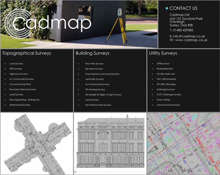


Cadmap Limited offer Topographic Land Surveys, GPR Utility Surveys using Ground Penetrating Radar to PAS128 standards and Measured Building Surveys, we provide a wide range of specialised surveying services. We produce Land Surveys in London Surrey and beyond, Measured Building Surveys London and surrounding areas, Measured Building Surveyors in London, Site Level Surveys , Site Engineering Setting Out in London, Movement Monitoring Surveys for structural investigations, PAS 128 Underground Utility GPR Surveys London and surrey, and CCTV Drainage Surveys operating primarily in Surrey and London, Southampton, Portsmouth, Brighton, Sussex, and the South of England. Land and building surveyors Surrey. Drone Surveying and UAV Drone Survey carried out to tight specifications.
Cadmap Limited are committed to delivering precise and reliable Digital Survey Data surveying solutions across Surrey, Sussex,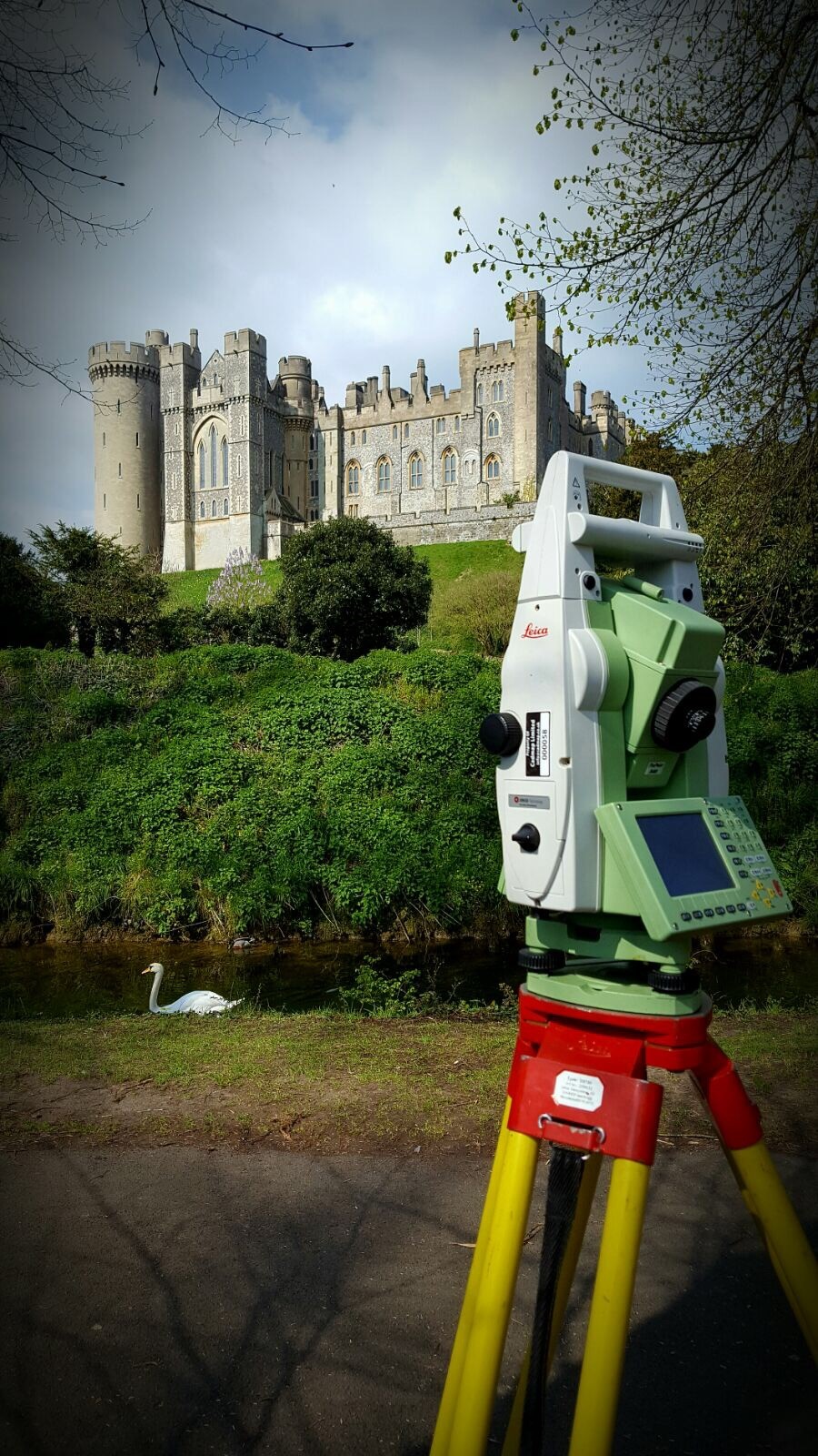 and London.
With commitment to accuracy and detail, we specialise in Topographical Surveys, Measured Building Surveys, and PAS 128 Utility GPR Surveys, delivering comprehensive data that supports informed decision-making for a wide range of projects.
Our experienced team utilises the latest technology and industry standards to provide high-quality, actionable insights for architects, engineers, planners, and developers. From mapping out existing landscapes with detailed topographical data to capturing essential structural information in our measured building surveys, and identifying underground utilities with our PAS 128-compliant Ground Penetrating Radar (GPR) surveys, we ensure every aspect of your project is thoroughly mapped and documented.
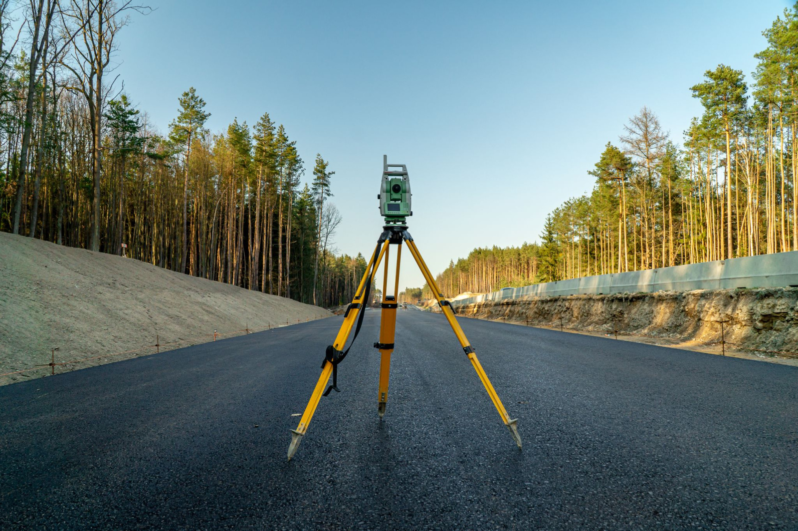
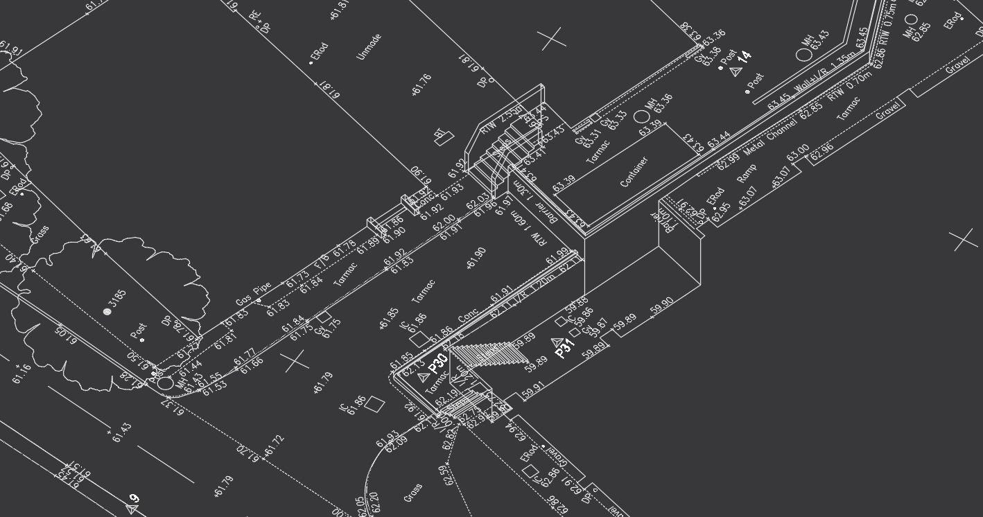
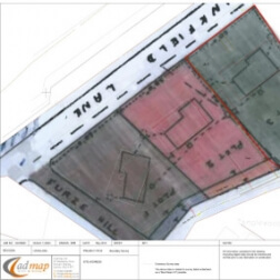
A Topo survey below:
The company has over 30 years experience within the construction industry, providing professional Land Surveys and Measured Building Survey drawings to developers, architects and Civil And GPR Utility Surveying (GPR) and CCTV Drainage Surveys.
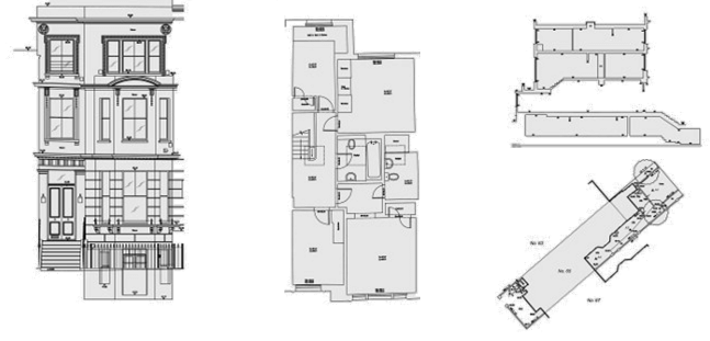
Measured Building Surveys London.

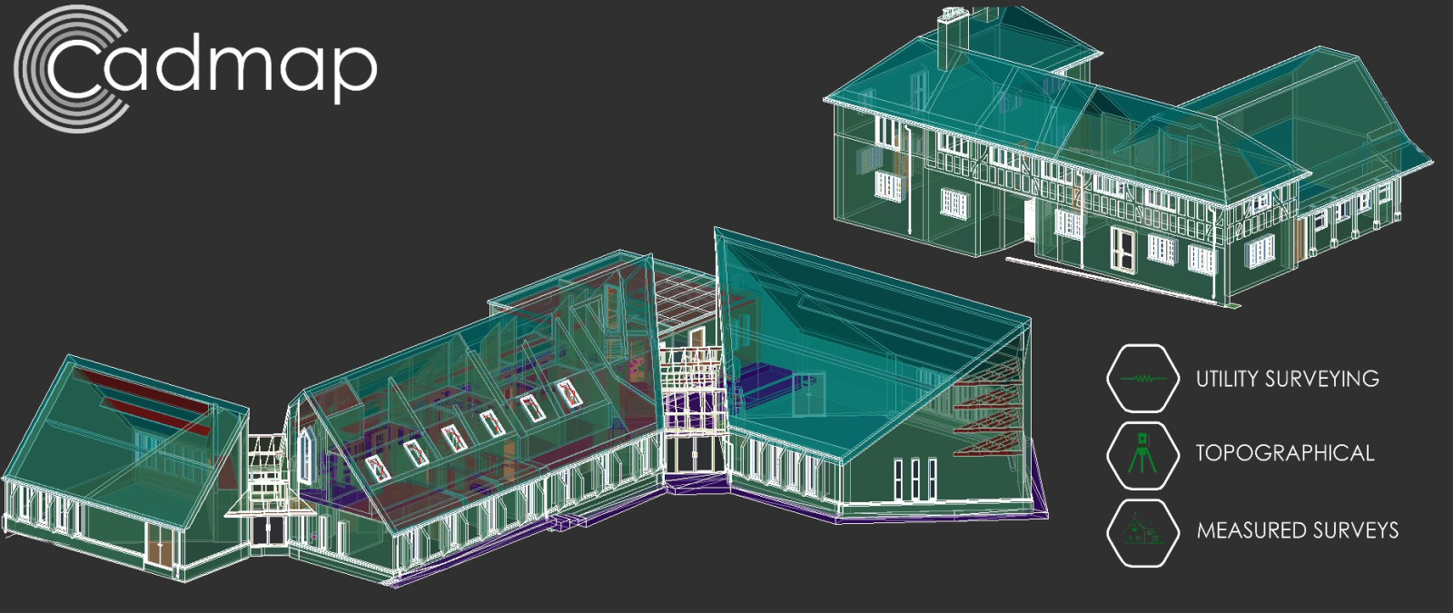
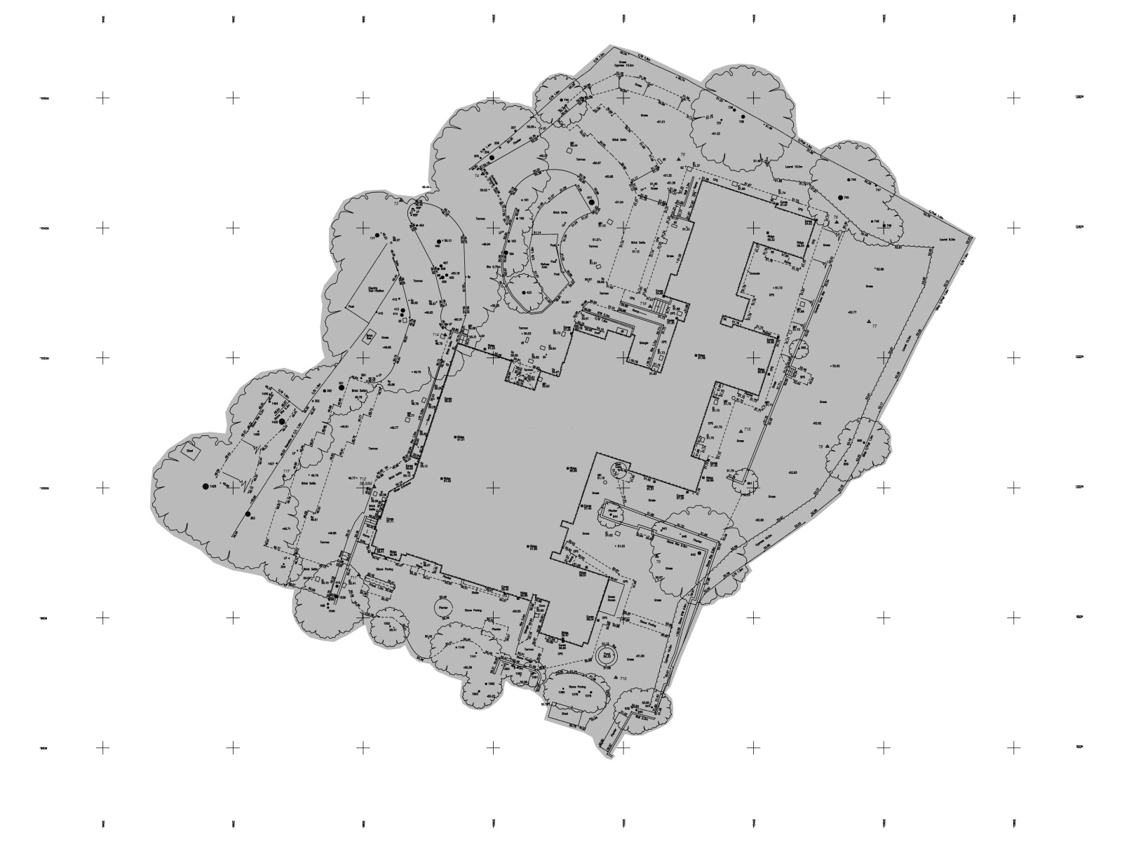
Example 3D Topographical Survey undertaken in Cobham.
At CADMAP, we prioritise client satisfaction and precision in every surveying you navigate even the most complex projects with confidence. Explore our services to see how our expertise can drive your project forward efficiently and accurately.
Land Surveyors London Surrey
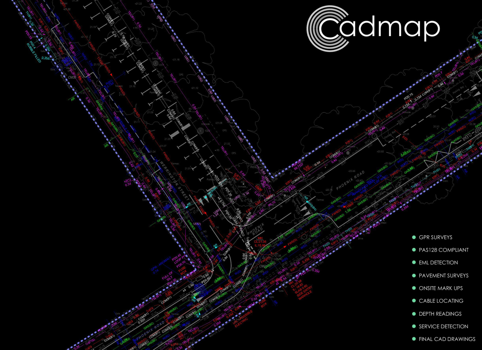
GROUND PENETRATING RADAR SURVEYS

FULL MEASURED BUILDING SURVEYS LONDON

TOPOGRAPHICAL LAND SURVEYS LONDON CALL US!
GPR SURVEYORS LONDON AND SURREY. QUOTE
Trusted Surveying Experts Across London, Surrey, Sussex & the UK
Cadmap Limited is a leading UK surveying company specialising in topographical surveys, measured building surveys, GPR utility mapping, CCTV drainage surveys, engineering setting-out, GIS mapping, 3D laser scanning, CAD plans, elevations, floor plans and sections. With decades of experience and a reputation for accuracy, reliability and fast turnaround, we support architects, developers, engineers, councils, construction firms, and property professionals across the UK.
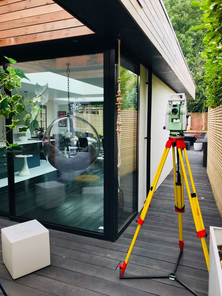
We deliver precise, fully connected RICS-compliant surveys using modern equipment such as Leica total stations, GPS/GNSS, 3D laser scanners, drones, and PAS-128 GPR utility tools. Every project is completed to the highest technical standards, ensuring the data you receive is accurate, coordinated, and ready for design, planning or construction.
Our Surveying Services
Topographical & Land Surveys (Highways, Sites, Estates)
We provide detailed topographical surveys for planning applications, design, highways, new builds, large estates, infrastructure and development schemes. All surveys include levels, features, boundaries, utilities, contours, and coordinated CAD drawings.
Measured Building Surveys
Accurate internal and external measurement surveys, including floor plans, elevations, roof plans, reflected ceiling plans, sections, and 3D BIM-ready models.
GPR Utility Mapping & PAS-128 Utility Surveys
Specialists in buried service detection using GPR, EM locators and PAS-128 methodology. Ideal for construction, excavation, highways and site feasibility studies.
CCTV Drainage Surveys
Full drainage inspections, mapping and reporting using CCTV crawler cameras, including manhole schedules, asset condition reporting, and drain jetting if required.
3D Laser Scanning & Point Cloud Surveys
High-density 3D scanning for measured buildings, heritage sites, industrial plants and complex structures. Output includes point clouds, 3D models and BIM files.
Setting Out & Engineering Surveys
Precise construction setting-out for gridlines, foundations, fencing, drainage, kerbs, roads and more.
GIS Mapping & Digital Data
High-quality mapping for land management, planning, utilities, environmental studies and asset management.
CAD Drafting & Survey Drawings
Professional CAD plans including building layouts, sections, elevations, title plans, lease plans and as-built drawings.
Why Choose Cadmap Limited?
✔ Highly accurate, fully coordinated surveys – All drawings are CAD-ready and produced using professional survey control.
✔ Modern equipment & advanced technology – Leica TS16, GPS/GNSS, GPR, CCTV crawler systems, 3D scanners, drones and GIS software.
✔ Fast turnaround with excellent communication – We deliver on time and keep you updated throughout.
✔ RICS-standard deliverables – Trusted by architects, councils, construction firms and major developers.
✔ Full multi-service survey provider – One company for land, building, utility, drainage and 3D surveys.
✔ Competitive pricing – High-quality surveys without the high-end cost.
✔ Trusted across London & the South East – Proven track record and extensive repeat clients.
topographical survey London
measured building survey London
GPR utility mapping London
PAS-128 utility survey specialists
CCTV drainage survey company
land surveyors UK
3D laser scanning and point cloud surveys
CAD drafting for architects and engineers
mapping and geospatial services
highway surveys and visibility splays
elevation and floor plan surveys
site measured surveys for planning applications

")

